
Day 60: June 1, 2026
On Day 60 the bad news is the jam ice is waiting around the next curve and some reconnaissance says the good news is that it opens in the curve after that.
-
Yeah, Will here. It's June 1st, day 60 on the Horton River.
When I got up, I went down to the river. The river had dropped about three feet and then I loaded up. The ice was gone, at least from what I could see on the inside bend of the river. So I backed up my raft. It's an operation where you put part of the raft in the water and you have to get the stuff stuffed in the backside. Well, the bow was in about eight inches of water during that procedure, just about half an hour to get everything set. And by the time we came to launch it, the bow was grounded. So it was dropping. I didn't know for sure what that was going to be. The river was still slow, meaning things weren't wide open.
So I was very cautiously around at the inside bend of this hairpin turn where it was all jammed up that was clear. It pushed way into the shore up about almost 20 feet in places. And then I rounded the curve again, and it didn't look good. There was kind of a getting pinched off on both sides, and I felt with the slow water, the ice jam was still up there. I didn't want to get caught in front of it. So I paddled into the inside curve where there was less current. There was still ice, walls of ice, so you couldn't get to either shore. And then I paddled upstream about half a mile. It was a lot of effort. And I was just going around bunches of ice. And then when I went around the points of the ice, I was sticking out this stronger current. And there was also more ice coming down, so I had to dodge that.
And then I finally got off to a point and found a spot on the inside of this curve. And it was, you know, not a real good campsite, kind of a muddy area. But I first just secured the raft, and then I spent about three hours walking up the river on what was on the inside of this curve just to see the extent of the ice. And it looked real bad for a while because there's another hairpin turn. And I felt that if it, if it plugged that hairpin turn all the way around, it would be a long wait.
And what's happening here was on these hairpin curves, there's water that flows down in the winter, this overflow. So in this case, this overflow was really thick. I don't know how thick it probably was, around 15, 16 feet. And that's what's really holding now all this ice behind it, this thicker ice. But I got around about a mile up, a mile and a half up or so. And lucky myself, the end of the ice jam, it was more of a jam ice thing. It was this thick ice. It just abruptly ended in the curve. It didn't go around much, much further. So that means there was just a front edge and current after that. So what I saw here was, you know, three-quarters of a ice jam at the beginning and this jam ice and all this stuff going. But it [... ...] the front side ...
[audio cuts out here]
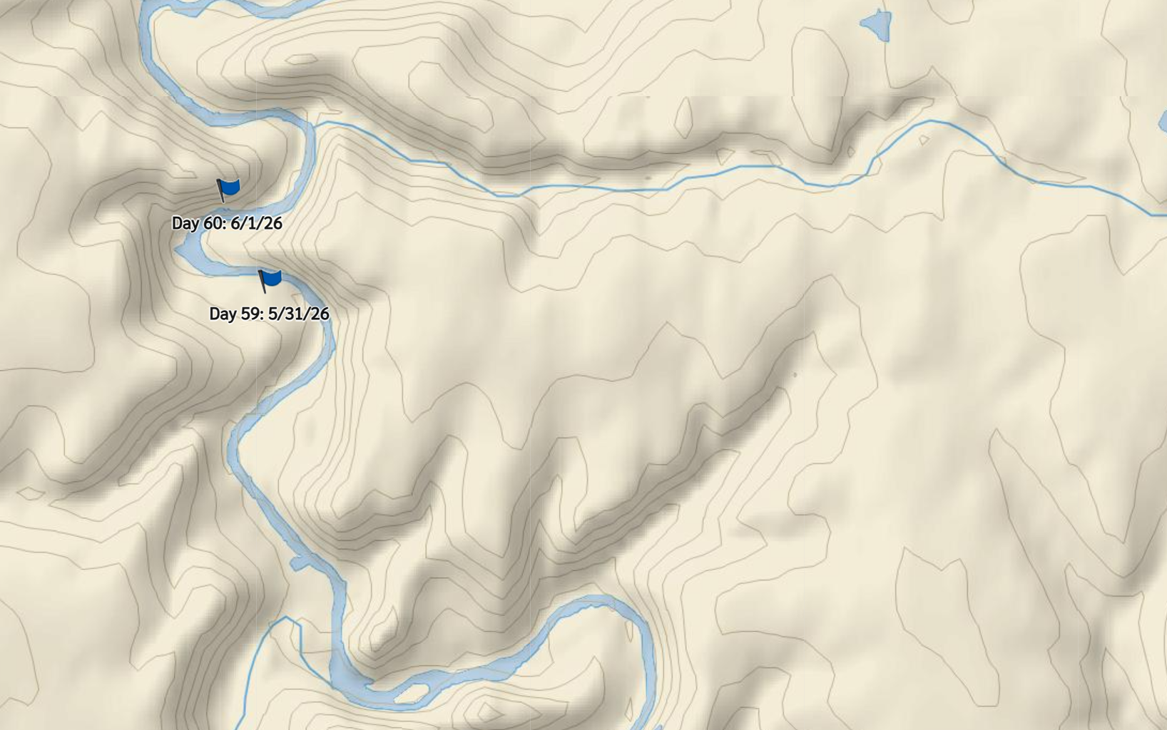
More ice jams require scouting to determine possible courses of travel. Visit Will’s interactive map for complete control of magnification and orientation.
In this video from the 2022 solo expedition Will observes flowing ice catching in a downstream ice jam. He chooses to halt travel to wait for the jam to clear before continuing travel.